Friday 23 November 2007

Mt.Sinai is really in Saudi Arabia... Ten commandements !!!!

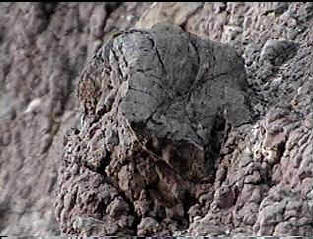
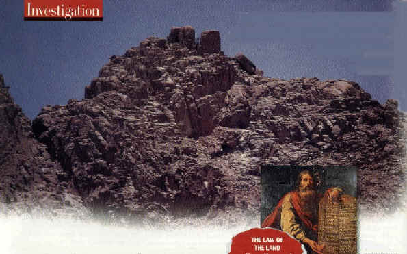
The Blackened Peak of the REAL Mount Sinai
found by Ron Wyatt

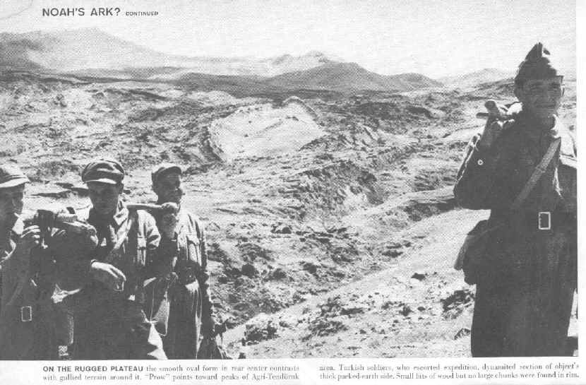
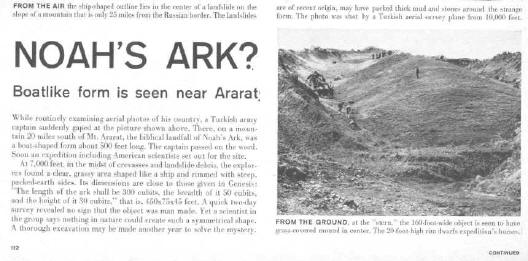
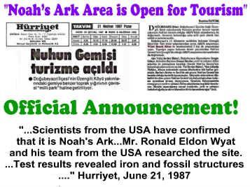
Above - Vanity Fair Magazine published a large article on the discovery of this mountain in the February 1998, issue, and featured many photos. Unfortunately the article centers around two gentlemen who came along after Ron Wyatt, but are claiming to have found the mountain. Mr. Wyatt told David Fasold about the discovery who then told the two men who went out in 1988, to see the mountain.

Ron was on CBS News in 1984, telling about his trip to see the mountain and what he found there. He had entered the country without a visa and was thought to be a spy. He nearly died in prison there. Here the magazine quotes Ron Wyatt:

Bible Texts Locate the Real Mount Sinai

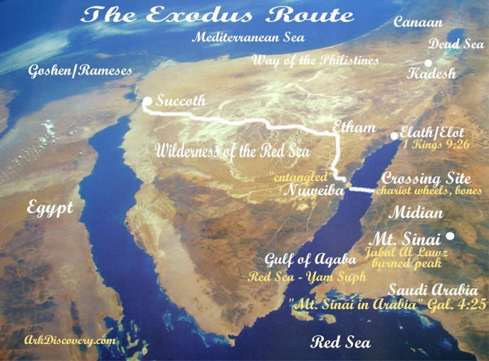
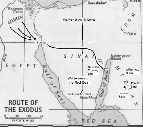
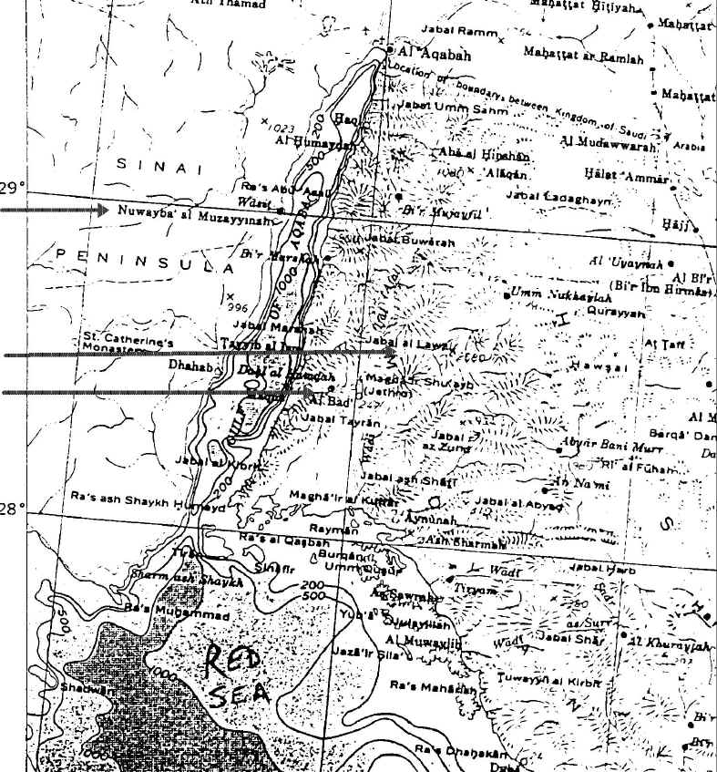
  • "Moses fled from the face of Pharaoh and dwelt in the land of Midian; and he sat down by a well" Ex. 2:15 NKJV. Maps indicate Midian is near the border of the Gulf of Aqaba in Northwest Saudi Arabia, in the area shown on the map above.

  • "And she [Zipporah] bore him a son, and he called his name Gershom; for he said, "I have been a stranger in a foreign land" Ex. 2:22. Moses was in a different country, away from any Egyptians in Saudi Arabia. He could not have been in the Sinai Peninsula, as that area was Egyptian controlled territory, full of Egyptian mines and communication towers. Moses would have been easily captured in that area.

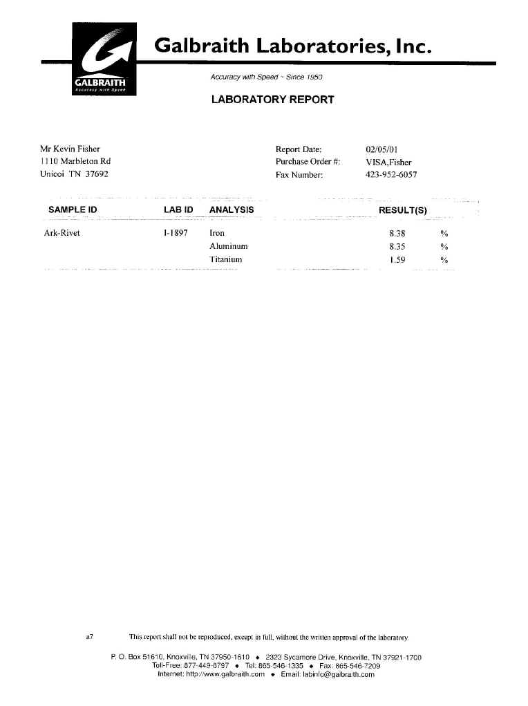
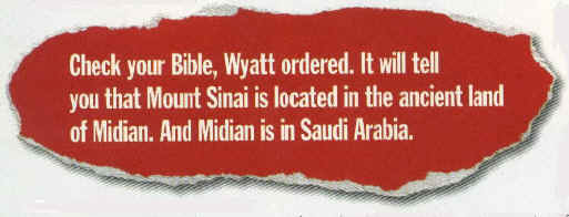
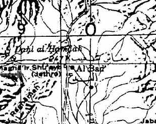
  • "Now Moses kept the flock of Jethro his father-in-law, the priest of Midian. And he led the flock to the back of the desert, and came to Horeb, the mountain of God" Ex. 3:1. Jethro lived in the vicinity of Mount Sinai. Jethro was the leader of the Midianites who were found in this area, "East of the Gulf of Aqaba in the northwestern regions of the Arabian Desert" Britanica. When researching the location of Mt. Sinai in Saudi Arabia that Mr. Wyatt proposed, I went to the East Tennessee State University Library and found two extremely detailed maps of Saudi Arabia. On BOTH maps I found the name "Jethro" next to the town of Al Bad, which is near Jebel el Lawz, the correct Mt. Sinai! See maps below. Jethro was Moses' father-in-law as we saw in the texts above. He was from the town of Al Bad, according to the local people who live there today, which is only about 15 miles from Jebel el Lawz. The local people there today told Ron Wyatt that Jethro was from that area.

    albadmap3.jpg (149509 bytes) Second map

  • "So He [God] said, 'I will certainly be with you. And this shall be a sign to you that I have sent you: When you have brought the people out of Egypt, you shall serve God on this mountain'" Exodus 3:12. Moses was to bring the children of Israel from Egypt to this same mountain in Midian, near Jethro's home, in a foreign land.

  • "For this Hagar is Mount Sinai in Arabia" Galatians 4:25. Here we are clearly told where the mountain should be located, in Arabia. But where is Arabia? "...It is bordered on the W by the Gulf of Aqaba and the Red Sea" Britanica. This clearly rules out the Sinai Peninsula, but it does include Saudi Arabia of course.

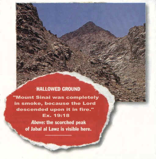
  • "Then, at this saying, Moses fled and became a sojourner in the land of Midian, where he had two sons. And when forty years had passed, an Angel of the Lord appeared to him in a flame of fire in a bush, in the wilderness of Mount Sinai." Acts 7:29,30. All historically accurate maps, such as some produced by secular companies such as National Geographic (see map at top of page), show Midian in Saudi Arabia. Unfortunately, maps placed in Bibles by the publishers may have Midian in the Sinai Peninsula in order to fit tradition, but not the Bible or the historical record.

Josephus Said It Was the Highest Mountain

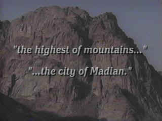
Josephus said that Mt. Sinai "was the highest of mountains in the city of Madian" which is just outside the town of Al Bad. Jebel el Lawz is the highest mountain in the upper two thirds of the country. Also, Philo said Mt. Sinai was located east of the Sinai Peninsula and south of Palestine.

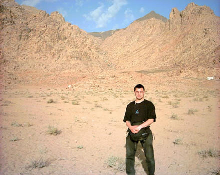
Above - Aaron Sen stands in the encampment area of Mt. Sinai with the blackened peak in the distance. www.wyattarchaeology.com

Layout of Mountain & Artifacts

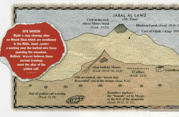
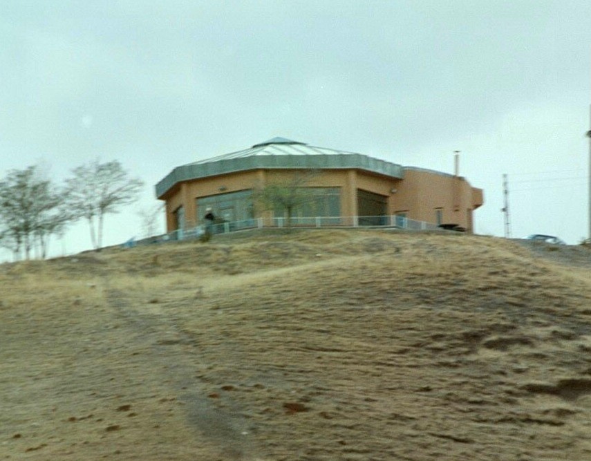
Mr. Wyatt is the original modern-day discoverer of the real Mount Sinai. The upper 200 feet of Jebel el Lawz is burned black, as we have seen in previous photos above. The Saudi Government will confiscate any photographs of the mountain and will not allow any tourists into the country, but U.S. Government satellite photos and a few private photos smuggled out of the country reveal the secret mountain by its unique blackened peak. Unlike the traditional site, there are thousands of acres in which to encamp at the base of this mountain, while clearly being visible from the mountain top.

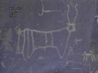
Tree Between Two Boulders

Top portion of photo shows a solitary tree between two boulders.

Mt. Sinai Found - Part II

The Altar of the Golden Calf


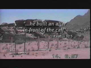
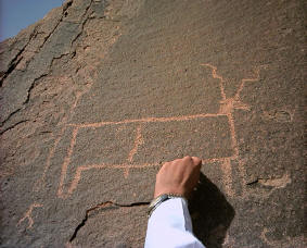
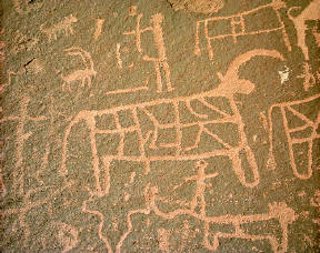
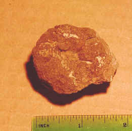
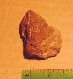
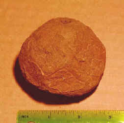
Above left - A dozen giant boulders are stacked in the encampment area and reveal 12 ancient Egyptian petroglyphs of bulls. It is believed the golden calf was placed upon these rocks. Large altars are found on the east and west sides of the mountain. (two upper photos Viveka Ponten) (two lower photos courtesy Aaron Sen

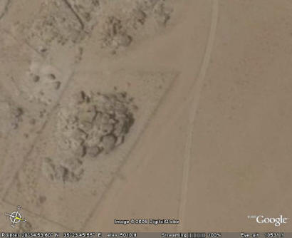
Above: Using Google Earth you can see the fence around these large rocks, out in the encampment area.
Rocks: 28 34' 52.78" N 35 23' 46.06" E
Guard house & fence: 28 35' 12.50" N 35 23' 08.36" E

Government Acknowledges Archaeological Significance


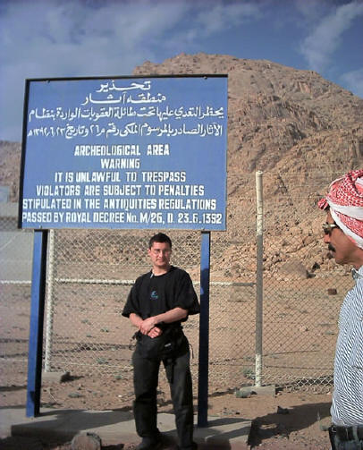
Above - Aaron Sen stands next to government sign at base of Mt. Sinai acknowledging this archaeological area. Photo Aaron Sen www.wyattarchaeology.com

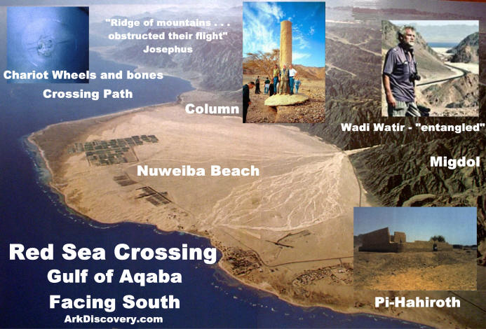
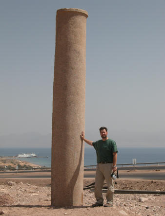
After Mr Wyatt found this site in 1984, and visited it again a year later, the Saudi government erected a fence and a guard house preventing access to the Holy Precinct area at the foot of the mountain on the eastern side. The sign above states, "Archaeological area...unlawful to trespass, subject to penalty." When Ron and his two sons made their fist trip into Saudi Arabia, they were accused of being spies and were held prisoner for two months, awaiting execution. After Ron helped to heal many sick prisoners, the authorities listened to his story and accompanied him to the column at the Saudi beach, then to Mt. Sinai. It was then they believed him, but they had to confiscate his photographs before letting him go.


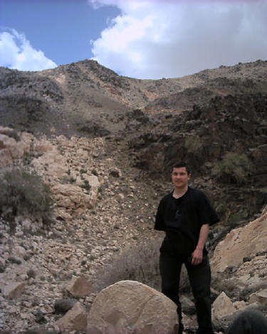
Above - Aaron Sen stands at base of Mt. Sinai with a broken column at his feet. www.wyattachaeology.com


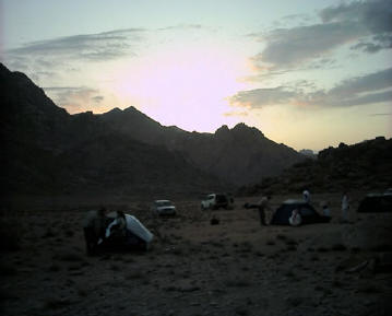
Aaron Sen camps overnight in the same spot where Moses and the Children of Israel lived for a year at Mt. Sinai. www.wyattarchaeology.com

The Rock which Flowed Forth Water

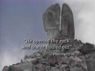
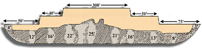
On the western or back side of the mountain is Rephidim where Moses and the Children of Israel first encamped before reaching Mt. Sinai. It was here that Moses struck the rock, above, which gushed forth large quantities of water. The giant 60 foot rock is on a 300 foot tall hill, and has obvious signs of water erosion, yet it is located in this desert region. The fissure in the rock is so large that you can walk easily through it. A square 20 foot altar is also at this site, which was built after the Children of Israel defeated the Amalakites. The Amalakite territory covered "south of Judah and probably extended into northern Arabia" Britanica.


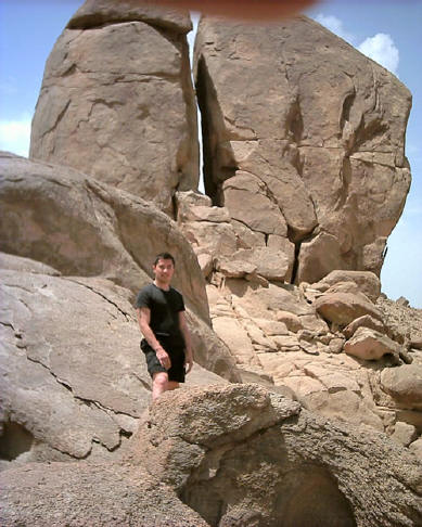
Above - Aaron Sen stands at base of the giant split rock which God provided for the Children of Israel. www.wyattarchaeology.com


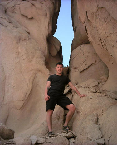
Above - Aaron Sen stands in the split of this giant rock. Notice the obvious signs of erosion,
in this desert region.

Some Television Coverage

Hershel Shanks, editor of Biblical Archaeology Review was quoted in Newsweek that "Jebel el Lawz is the most likely site for Mount Sinai." Dateline NBC has featured Jebel el Lawz in one of its reports.

When Mouses and Israel Crossing the Red Sea with God...

The Red Sea Crossing

The Traditional Site

There is a traditional route of the Exodus which has the children of Israel wading in shallow water through an area north of the Gulf of Suez while the tide was out. This area cannot be the crossing site as it does not match the biblical account. A shallow area of water could not drown all of the Egyptian army. Also, they were to leave Egypt proper before encountering the Red Sea crossing. After crossing the Red Sea, the Bible says they encountered the mountain of God or Mount Sinai which is in Midian. Midian is not in the area we call today the Sinai Peninsula. It is instead in Saudi Arabia and can be found on most maps in that location. The traditional Mt. Sinai was "found" by Constantine's "psychic" mother who in the fourth century went around the Holy Land pointing out various sites as the "authentic" biblical sites, such as the birthplace of Christ, the church of the Holy sepulcher (which was a pagan temple during her time), etc. There is no archaeological evidence of the forty year existence of the children of Israel in the Sinai Peninsula.

The Majority of Archaeologists

The majority of archaeologists today do not have enough faith in the Bible as the accurate word of God. The majority of archaeologists do not even believe in the exodus of the children of Israel from Egypt, according to Hershel Shanks, editor of the Biblical Archaeology Review magazine. They are skeptical of the biblical account, perhaps because of a lack of archaeological evidence in the Sinai Peninsula and a lack of faith. We cannot look to these men to tell us where or if the exodus took place.

The Red Sea Crossing Site Found by Ron Wyatt

The children of Israel lived in the Nile delta area or the land of Rameses, and first encamped at the northern end of the Gulf of Suez or Succoth at the beginning of the Exodus. This was the first point where they went into the camping mode. Then they traveled through the wilderness of the Red Sea, or what we

call today the Sinai Peninsula, and encountered the Gulf of Aqaba. (I Kings 9:26 calls this the Red Sea.)

The Wilderness Has Them Entangled


Wadi Watir had the Children of Israel "entangled." Exit point at the large beach at Nuweiba (2005)

When traveling through "the wilderness of the Red Sea" Ex.13:18, escaping Pharaoh's army, God told Moses to turn south, so they headed through a wadi or canyon area that is called the Wadi Watir which led to the sea. The Bible in Ex. 14:3 says, "They are entangled in the land, the wilderness hath shut them in."

Above, the Wadi Watir winding its way to the Red Sea Crossing site at Nuweiba, had the children of Israel
thinking Moses had made a wrong decision to bring them this way.

The Beach Where the Crossing Took Place

When arriving at the beach, the children of Israel felt trapped, as they could not turn back, nor head north because at the northern end of the beach was a three story, Egyptian military fortress which is still standing today undergoing restoration.

Egyptian military fortress, possibly Migdol, blocked any northern escape route (photo 2005)

Additionally there were mountains obstructing their escape. To the south the mountains came down to the sea, as mentioned by Josephus, "For there was [on each side] a [ridge of] mountains that terminated at the sea, which were impassable by reason of their roughness, and obstructed their flight" Antiquities of the Jews, Bk. 2, 15-3. You can see the mountains at the beach today. The people were about to turn against Moses because he had led them to an area where they were trapped and would surely die, or so they thought.


(Aerial Photo 1982 National Geographic)

If one looks on a map for a beach area large enough for 2 million people to encamp on the gulf there is only one candidate: Nuweiba Egypt. The beach at Nuweiba is extremely large and could have accommodated a large number of people at the time of Moses. Today you will find many hotels there and a village.

The Granite Column of Solomon

This column matches one on the other side of the gulf in Saudi Arabia which had the inscriptions intact. The Hebrew words Egypt, death, water, pharaoh, Edom, Yahweh, and Solomon were on that column. Apparently one can conclude


Kevin Fisher at the red granite column, marking the crossing site (Oct. 2005)

King Solomon had these columns erected 400 years after the miracle of the crossing of the Red Sea on dry land. Solomon's sea port was at the northern tip of the Gulf of Aqaba at Eilat (I Kings 9:26) and he was very familiar with the Red Sea crossing site, as it was in his neighborhood. The Bible even mentions this column! Isaiah 19:19, "In that day there will be an altar to the Lord in the midst of the land of Egypt, and a pillar to the Lord at its border." You can visit the beach today and see the column in person, as I was able to do in Oct. 2005.

Gradual Contour of Seabed

God caused a strong east wind to blow the waters back so the people could walk ten miles through the Red Sea to safety in Arabia. The crossing path is about a quarter to a half mile wide and is on a gradual slope down

The Bible tell about Noah arks...

The Bible

There is only one verse in the Bible which gives us a hint of where we the ark came to rest, "the ark rested...upon the mountains of Ararat." Genesis 8:4. Where is Ararat? The name Ararat is a large area or ancient country covering eastern Turkey, western Iran and western Russia, as shown in yellow below.

"The name Ararat, as it appears in the Bible, is the Hebrew equivalent of ...Urartu, ancient country of southwest Asia...mentioned in Assyrian sources from the early 13th century BC" Encyclopaedia Britanica 15th ed. Some have mistakenly assumed the Bible meant the ark came to rest on Mount Ararat (Agri Dagh), but that is not the case. Mount Ararat is 17,000 feet tall, and is a post-Flood volcanic mountain that gained its height after the Flood, therefore there is no reason to assume it is a more likely candidate for the resting place of the ark, instead it is a less likely candidate. The ark came to rest in the mountains of the ancient country of Urartu, not on Mt. Ararat.

The Ancient Historical Record

Flavius Josephus, c. 90 AD, the famous Jewish historian stated, "Its remains are shown there by the inhabitants to this day." He quotes Berosus the Chaldean, c. 290 BC, who indicated tourists would take home pieces of the ark for making good-luck charms, "It is said there is still some part of this ship in Armenia, at the mountain of the Cordyaeans; and that some people carry off pieces of the bitumen, which they take away, and use chiefly as amulets for the averting of mischiefs." These comments tend to indicate its location would not be in an inaccessible area. At some point, the ark was covered by a mud and lava flow which caused future generations to lose its location.

Life Magazine 1960

The 1960 expedition to the ark found a formation whose top sides were even with ground level as seen in the photos above. The site researched by Ron Wyatt is 18.2 miles south of Mount Ararat at the elevation of 6,524 ft., in the "mountains of Ararat." A Turkish captain, Llhan Durupinar, was reviewing NATO Geodetic Survey photographs of the area in 1959, and noticed a boat shaped formation. Others in the U.S. then analyzed the photograph including Dr. Arthur J. Brandenburger, world famous expert in photogrammetry, who said "I have no doubt at all that this object is a ship. In my entire career I have never seen an object like this on a stereo photo. Even the approximate length of the object fits" The Ark File, p118. An expedition sponsored by a party from the U.S. included among others, Rene Noorbergen, later author of The Ark File; and George Vandeman, evangelist, and Dr. Brandenburger. They made a visual inspection of the site and conducted no scientific studies, only some digging and dynamiting of the ark and and mistakenly concluded this site was just an "odd geological formation." The expedition was expecting to find on the surface of the ark "petrified beams" The Ark File, p126, by digging in a few places. An article then appeared in the September 5th, 1960, Life magazine, shown above, revealing a very impressive aerial photo of an extremely large boat-shaped object, plus two photos taken by the expedition. Seventeen years later in 1977, Mr. Wyatt made his first of 24 trips to the ark, and he was impressed that this really was the remains of Noah's Ark! In the research he performed over the next 15 years, Mr. Wyatt successfully performed metal detection tests and subsurface radar scans of the site, and he proved this site really IS the mud-and-lava covered remains of Noah's Ark!

Government Confirmation:

Visitors' Center Opened

The Turkish government has double-verified Mr. Wyatt's tests, and they have given him credit for the discovery. The announcement appeared in Turkey's largest newspaper on June 21, 1987. The area was first designated a National Park, and then it was upgraded to the status of a National Treasure. The government has built a visitors' center overlooking the site and issued official tourist brochures so people of all races can come and see the ark!

arkvisit.jpg (18083 bytes)

visitorc.jpg (120187 bytes)


Above - visitors' center at Noah's Ark National Park which overlooks the ark site. (2002)

The Announcement of the Discovery

Translation of newspaper article announcing the discovery of Noah's Ark:

"THE NOAH'S ARK OPENED TO TOURISM. The surrounding area of a ship-like soil pile nearby the village of Uzengili within the township of Dogubeyazit as a national park. Dogubeyazit - The American Academians confirmed the soil pile nearby the village of Uzengili in the township of Dogubeyazit is Noah's Ark. The surrounding area is declared to be a national park and it is opened to tourism. 15 Km away from Dogubeyazit at the village of Uzengili, Ronal Eldon Wyatt and his colleagues, an American research group, made researches after their Turkish colleagues completed their investigations. Upon analyzing the soil structure and finding specific iron pieces and particles, the American researchers concluded that Noah's Ark is located at Uzengili village. With a ceremony attended by the Governor of Agri Province, Subgovernor of Dogubeyazit township, the Mayor Usha, Mr. Osman Baydar and the local and foreign scientists and researchers and a group of citizens, the Noah's Ark is opened to touristic visits. The Governor Serket Ekinci said, "In recent years, Turkey has become one of the countries to be visited in worldwide tourism. It is assured that the Noah's Ark, mentioned in Quran and the Bible, is located here. I am honored to pen this area having the Noah's Ark which attracts attentions of millions in the world. I owe our thanks to those national and foreign scientists and researchers contributed to the researches so as to locate Noah's Ark. At the social facilities to be built, we will accommodate local and foreign tourists and have our country make hard currency." translation courtesy Val Smith www.throneofgod.com

Government sign directs your way to the ark

Kevin Fisher standing in the "Valley of Eight" along the main highway, this government sign points your way to "Noah's Big Boat." Behind me is the border with Iran just a short distance away. To my left and up on the mountain 5 Km away, lies Noah's pride and joy.

The Length Matches the Biblical Record!

Noah's Ark at 515 feet compared to the U.S.S. Kitty Hawk aircraft carrier. Graphics Mark Johnson, ArkFind.com

The length of the ruins of the ark is 515 ft., which is exactly 300 Egyptian cubits (20.6 inches)! Moses was schooled in Egypt and was not familiar with the Hebrew cubit which was not even in existence when Moses wrote Genesis.

The brown material above represents the outline and shape of the ark today. The Bible said there were three levels, and based upon the present depth of the ark, it may have originally appeared as shown above. (diagram courtesy anchorstone.com)

Ark Excavated by God


Pre-earthquake photo

The photo above shows the ark deeply embedded in the surrounding terrain. In 1978, when Mr. Wyatt was returning to Nashville, he prayed that God would send an earthquake to "excavate" the site. When arriving in Nashville the headlines read, "Earthquake in Eastern Turkey." The earth dropped from around the sides of the ark, defining the formation more clearly and making it more accessible for research.

Metal Used in the Ark!

The ark contains a large amount of metal fittings used to secure the large timbers together. These two photos below are from our October 2000, trip to the site. Notice how there was once two large rivet fasteners, but now only one is left. A large metal plate was positioned behind the rivets. I received a positive metal reading when passing the metal detector over the rivets. We should not be surprised to find metal alloys used in the ark, because Genesis 4:22 states, "Tubal-Cain, an instructor of every craftsman in bronze and iron."

(Left) Ron Wyatt found a beautiful specimen of one of the metal rivets used on the ark. It was tested and found to contain high-tech metal alloys, such as titanium, magnesium, and aluminum, etc. Critics have said Ron did not find this fine specimen on the ark but just manufactured it. Well, as you will see below, we found the same objects and had them tested. They too proved to have the same metals, in the same percentages! (Below) Two rough rivets in lower portion of photo.

Our Own Metal Samples Tested

Lab Report Shows Fossilized Rivet Contains Man-Made Metals!

arkrivettest.jpg (43363 bytes)

Below is what appears to be part of a large washer that would have been slipped over a shaft and then secured on the shaft by flaring out the end of the shaft. We have drawn circles on the photo to demonstrate the circular effect in the specimen. The surrounding material on the side of the ark around this object had a greenish color. Assuming a circular shape, this sample would be the same size as the rivet found by Mr. Wyatt. (The photo at right is of the rivet as we found it on the ark)

Galbraith Laboratories of Knoxville Tennessee has tested the specimen for three metals I requested. I asked them to test for aluminum metal, iron metal, and titanium metal. It costs $60 to test for each metal requested. The results show 8.35 % iron metal, 8.35% aluminum metal, and 1.59% titanium metal. ALUMINUM AND TITANIUM METALS ARE NOT FOUND IN NATURE!!! THIS OBJECT IS MAN-MADE, USING ADVANCED TECHNOLOGY!! These results are similar to those produced in the analysis of the rivet found by Mr. Wyatt. Since the specimen is fossilized, it is assumed a large portion of it is now silica replacement, reducing the percentage of metal that was originally in it when it was made. These rivets are found in several locations on the outside of the Ark, and are probably buried inside the Ark by the hundreds or thousands. In comparison to others, this specimen is in poor condition.

Second specimen is also man-made with aluminum metal!

The second item I had tested by the lab reveals that is is also man-made. It was found on the side of the ark. It produced positive metal reading with my metal detector when I was at the site. Later in Istanbul, I tested it with a magnet which produced an attraction to it. It appears to have been flared out (left photo) by pounding the center when it was hot. The left hand photo is facing us the way it appeared on the starboard side of the Ark. Notice the side view (right view) which shows the tapering effect. Test results from Galbraith Labs, completed in June 2001, reveal it has man-made aluminum metal in it! It contains 8.08 percent aluminum metal, 8.24 percent iron metal, 1.34 percent titanium metal, and 3.82 percent magnesium metal. Click on thumbnail to read lab report.

arkspec_2.jpg (20202 bytes)

This may be the end of a metal rod. Turkish officials reported removing four foot long metal rods from the site.

Metal Bracket

In May, 1985, Dr. John Baumgardner of Los Alomas Labs, was inspecting the ark with a metal detector when he became startled and said, "Undecomposed Iron!" A rectangular beam was protruding from the side of the ark, with iron flakes. He found a beautiful right angled wrought iron bracket which had been stretched and hammered, showing preferential gradiance. John tested it at Los Alomas Labs and it was found to be 91.84% iron FE203.

Ballast?

Below is a suspected piece of metal ballast that may have been thrown into the bottom of the ark when the craftsmen were through forming metal brackets and had metal waste left over. Notice the concave features on almost every side, where other pieces of ballast were pressed against it when it was still hot. I found this near the ark. (Two photos of same item.)

Metal Wedge?

This appears to be some manganese ballast which was poured into the hull in a liquid state,
then hardened and took the curvature of the hull (right photo). It has a coating on the convex side, while the flat side appears to be metal. Found a few feet away from the ark.

Ballast Found by Wyatt

This is an example of the metal ballast that has been found in the hull of the ark. It is made up of manganese primarily, which is a by-product of forming magnesium that was used in the metal rivets. Found by Ron Wyatt.

Square Object with "X" Impression

The western side of the ark had this square object that had the appearance of metal on its top and three sides.. It also contained an impression in it, much like it had been struck while it was hot. It was at a higher level where I could not measure it. It may have been 8 inches in diameter.